
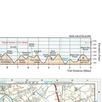
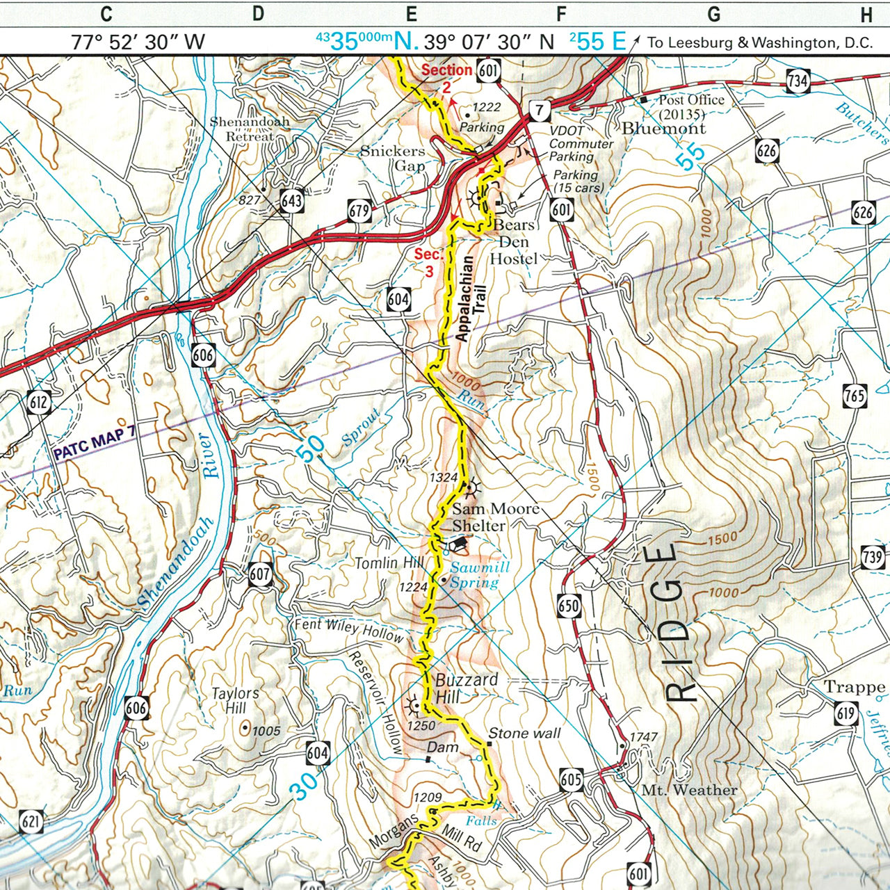
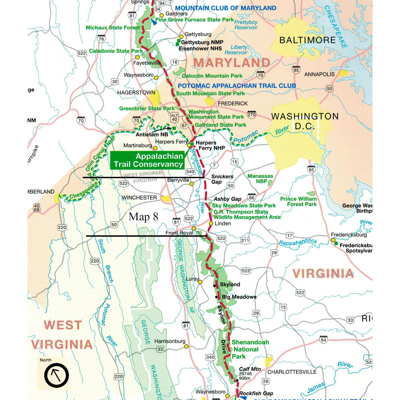
The official Appalachian Trail maps are essential hiking materials for both thru and section hikers. Each map is focused on the Appalachian Trail and overlaps with the neighboring maps, ideal for long-distance hikes and planning. The surrounding area and additional side trails are also included. An easy-to-use elevation profile shows the distance to the next campsite or shelter, side trails, and water sources. For added interest, maps indicate road crossings, waterfalls, and scenic areas. Maps are both water- and tear-resistant.
Map 8: Appalachian Trail in Northern Virginia – South Half; Snickers Gap to Chester Gap.
Published by Potomac Appalachian Trail Club: 1:63,360-scale, 100 foot contour interval topographic maps. GPS compatible. Revised 2013.
The official Appalachian Trail maps for Northern Virginia are also available for sale in an official Appalachian Trail Guide Set (24185) with Maryland for more in-depth planning.